OPEN LETTER
On February 1, 2018, a provincial conference on flood management will be held in Drummondville, organized by the Grouping of Quebec watershed organizations (ROBVQ) and the Interuniversity research group in limnology and aquatic environment (GRILL). The organizers mention that “the time has come to equip decision-makers to prevent new crises and to establish a dialogue between actors around existing, concrete and applicable solutions. » To this end, the signatories of this letter consider that the Ministry of Sustainable Development, Environment and the Fight against Climate Change (MDDELCC) should renew a government program for determining and reviewing flood zones in Quebec. They also invite municipal administrators to reconsider any development projects near watercourses, including within 100-year recurrence zones.
Since 2004, there has been no government program relating to the determination of flood zones. However, the cartography provided is far from complete and the vast majority of maps produced were for the St. Lawrence Lowlands. Today, the MDDELCC participates in mapping through agreements and partnerships with local authorities. The responsibility for mapping flood zones in Quebec has thus been passed on to municipal authorities, which presents certain problems. First, it is an additional financial burden for small municipalities, which sometimes struggle to justify such an expense, despite increasingly obvious needs. The other problem concerns the methods for determining flood zones which are diverse and are not currently regulated from a regulatory point of view. Without calling into question anyone's integrity, this situation opens the door to studies that can better respond to the needs of individuals rather than the reality of the environment studied. In addition, it happens that municipal authorities do not have enough knowledge to judge the validity of the studies submitted to them, for example, by a real estate developer. The renewal of a government program for determining flood zones or, at the very least, a regulatory framework standardizing delimitation methods would eliminate this ambiguity.
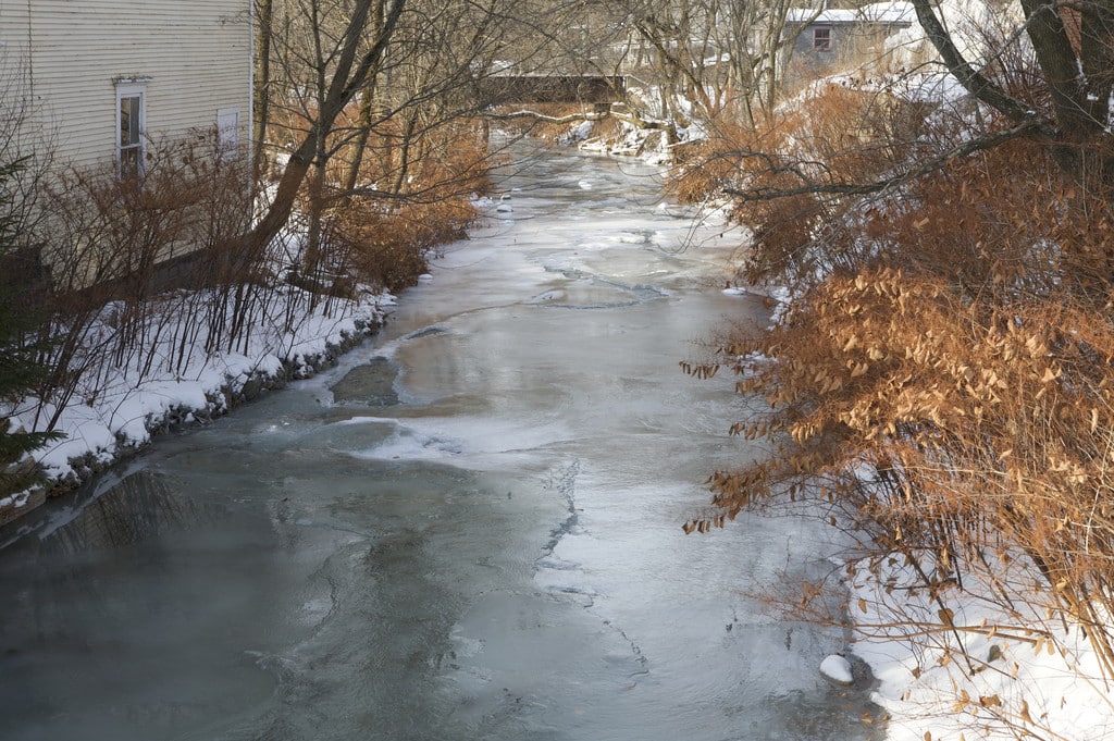
The Sutton River in Montérégie is a good example. Located at the foot of an imposing mountain range, this small meandering stream flows through the heart of the town of Sutton and is sometimes subject to spectacular floods. Over the past 50 years, long-time residents have seen the river burst its banks at least three times (1969, 1997 and 2011), well beyond the limit of the recurrence zone of 100 years currently recognized. An outcry took place when a real estate development project in a flood-prone section of the Sutton River was submitted to the town hall. It took nearly a year of dialogue between citizens, the city and the MRC Brome-Missisquoi for the adoption of an interim control regulation serving to revise the areas at risk of flooding in the sector of the urbanization perimeter of the downtown Sutton. Had it not been for the vigilance of the citizens of Sutton, this real estate project would most likely have been authorized without any independent assessment of the situation, exposing future properties to the risk of flooding. This example illustrates how municipal authorities must be concerned and transparent regarding any project near watercourses, as well as the need for a review of flood zones on a national scale. It goes without saying that Quebec municipalities must be required to integrate such mapping into their development plans and that this mapping must be accurate if we wish to adapt to the reality of flooding in the province.
With the recent publication of the Law on the Conservation of Wet and Water Environments, indicating the importance that the Government of Quebec attaches to these environments, we dare to believe that proactive support from the MDDELCC in determining flood zones will be recommended in a near future. With the risks associated with poor delimitation and the often irreparable harm caused by flooding, this would be to the benefit of all, socially, economically and ecologically.
Just since the start of 2018, flooding on the Mille-Îles River in Terrebonne, the Saint-Charles River in Quebec and an ice jam on the Yamaska have made headlines. There is no longer time for dialogue; faced with the impacts of climate change and the speed with which they occur, ensuring an adequate definition of flood zones for Quebec's rivers and limiting any new human intervention there would be a sustainable preventive solution, a step forward towards the healthy adaptation of our cities to the climate change and better protection of ecosystems.
Signatories:
- Gabriel Cliche, B. Sc A., project manager, Fondation Rivières
- Louise Gratton, M. Sc. Biology, consultant in ecology and conservation, resident of Sutton
- Diana Dyer, retired teacher, resident of Sutton
Photo: Sutton River, Denis Chabot