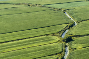
Ce n’est un secret pour personne : il y a tant de belles chutes au Québec!
Vous pouvez accéder ici au Guide des chutes du Québec
Mais saviez-vous que plusieurs seraient probablement disparues sans l’opération Adopt a river? This movement led by citizens and artists caused the Quebec government to falter, as it planned to authorize the construction of private hydroelectric dams. Result: 36 falls on around twenty rivers in Quebec were saved! A victory for nature and for the emergence of ecotourism projects. She even gave the inspiration she needed to Roy Dupuis and his allies to co-found the Fondation Rivières!
Here are 5 magnificent falls in Quebec and useful information for visiting them
Canyon Sainte-Anne waterfalls, Capitale-Nationale

You have certainly already visited it: the Sainte-Anne Falls canyon in Quebec welcomes several thousand people each year! This important recreational tourism site has not always had such an appearance. At the beginning of the 20th century, the Sainte-Anne River was used for floating logs and was even dynamited to facilitate their descent. In 1965, Jean-Marie and Laurent McNicoll purchased the wooded land surrounding the falls and leased the banks of the river from Hydro-Québec. The first visitors had access to the Sainte-Anne Falls canyon almost a decade later.
- Walking trail: marked
- Degree of difficulty: easy-intermediate (sidewalks and wooden stairs); Accessible to people with reduced mobility
- Attendance: very high
- Facilities: platform, bridge, walkway, interpretation panels, observation tower, toilets, picnic tables, BBQ area, shop, information kiosk, restaurant
- Activities: hiking, guided tour in a shuttle
- Coordinates: 47° 04' 28'' N / 70° 52' 36'' W
- Access: Provide a right of access
Sainte-Ursule Falls, Mauricie

Located in the Parc des Chutes de Sainte-Ursule, the filiform falls extend over several kilometers and flow over many levels. The trail along the Maskinongé River is mainly made up of stairs that lead to an observation tower. The view of the falls is magnificent! In winter, the landscape is magical and the power of the 73 meter high falls promotes a meditative state. At the end of this route, we find ourselves on a point from where we see the river going in the opposite direction in a serpentine furrow. In summer, the place is well chosen for a picnic.
This site was once an important hub of the local economy. Indeed, a sawmill and a pulp mill operated there, from 1811, for more than a century. The Sainte-Ursule Falls, located in a gorge, have interesting geological and geomorphological features, including pink granite, polished rocks and pots.
- Walking trail: marked
- Degree of difficulty: intermediate
- Attendance: average
- Facilities: platform, footbridge, observation tower, picnic tables, BBQ facilities, play area, refuge, restaurant
- Activities: hiking, canoeing, cross-country skiing
- Coordinates: 46° 18' 01'' N / 73° 05' 43'' W
- Access: Provide a right of access
Plaisance Falls, Outaouais

The Plaisance Falls also bear the names Sault-de-la-Chaudière, Chute du Moulin or Chutes de la Petite Nation. In the summer, the park located on the east bank of the Petite Nation River offers activities that allow you to become familiar with the history of the village. It is possible to admire the imposing 67 meter high waterfall from different viewpoints, as a path runs very closely along the river.
The site of Plaisance Falls Park was once home to a village that is remembered today as North Nation Mills. At the beginning of the 19th century, Joseph Papineau, father of the leader of the Patriotes and owner of the seigneury of the Petite Nation, had a sawmill built on the site near the falls. During the years following its construction, the operation of the mill passed through the hands of different entrepreneurs. The village developed around this industry, and the wood was transported mainly to England. The moving of the mill at the beginning of the 20th century marks the end of the village.
- Walking trail: marked
- Degree of difficulty: easy
- Attendance: average
- Facilities: picnic tables, platform, washrooms
- Activities: hiking
- Coordinates: 45° 39' 03'' N / 75° 07' 13'' W
- Access: Provide a right of access
Nine Falls, Mauricie

In the heart of the village of Notre-Dame-de-Montauban in Mauricie, the Neuf Falls flow proudly! On the main street, from the terrace of the Cinq Dollars Falls bar, the view is striking since you can see the monumental water spill in its entirety. After the village bridge, on the west side of the Batiscan, there is a parking lot at the top of the hill which leads to a path following the river to the falls. A path in the heart of a majestic old forest runs along the Batiscan River to the falls. Wooden installations allow you to move forward on the Batiscan River. This is the opportunity to open your eyes wide and appreciate the power of the 21 meter high falls.
- Walking trail: marked
- Degree of difficulty: easy
- Attendance: average
- Facilities: wooden platform jutting out onto the river
- Activities: hiking
- Coordinates: 46° 53' 13'' N / 72° 18' 01'' W
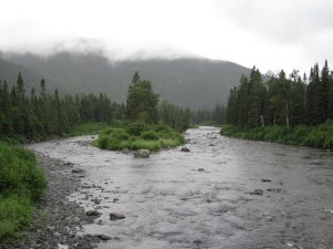
Third Magpie Falls, North Shore

The Magpie River is undoubtedly a jewel of nature and the fight for its preservation is not over! This river is recognized for its immense whitewater potential, but it is possible to admire its legendary Third Falls from the mainland. The wooded path that leads there is well defined, but before reaching it, you must take different paths in the forest. And since it is not maintained, you have to expect to encounter certain obstacles.
First walking on sandy ground, we quickly find ourselves in a forest covered in moss. We also pass a small summit that looks like the Great North with its Nordic flowers and lichen. Near the river, we notice an old abandoned camp that we must pass to access the falls. We first find ourselves at the top of the Third Falls. Two other viewpoints follow one another: it is the second which gives the best view of a totally enchanting setting!
No question here of considering a swim; we are in the great power of the river, where no peaceful basin is formed. You can catch your breath at the third viewpoint which overlooks a final drop. From a distance, we see the river returning to its calm course... until the next waterfall.
- Walking trail: unmarked
- Degree of difficulty: difficult
- Attendance: low
- Facilities: none
- Activities: hiking
- Coordinates: 50° 20' 10'' N / 64° 26' 22'' W
Explore the 36 saved falls of Quebec
Help us protect Quebec Falls
The content of this article was inspired by the Quebec Falls Guide.
Main photo: The Tonnerre waterfall is one of the spared falls. Credit: Pierre Leclerc
About the author

Sophie Lachance
Sophie is responsible for communications and mobilization at Fondation Rivières. A writer with journalistic training, she is interested in environmental issues, particularly in terms of water management.